Fenway

Today, a major holiday blockbuster makes its debut on screens worldwide. One which my wife won tickets to an advanced screening of at the Regal Cinemas Fenway Stadium 13. Though I highly implore you to see said movie, being a transit blog and not a random pop culture/politics blog, I’ll point out that this gave me a reason to visit Fenway, the station which sits right to the south of its host building, Landmark Center.

The first outdoor station on the D branch heading outbound, Fenway sits on the edge of the Emerald Necklace, not far from the Back Bay Fens (though the stations of the E branch are actually closer), with Park Drive above the station leaving part of the station covered by its overpass. Getting off at Fenway, however, the scenery is dominated by nearby Fenway Park which sits about a third of a mile away, the Citgo sign over Kenmore Square in clear sight and some “Take the (T) to Fenway” Red Sox signs on the rock walls on the outbound platform. In the recent past, Fenway saw a lot of usage by Sox fans on game days though the institution of fares on the outbound Green Line and Kenmore becoming wheelchair accessible has reduced ridership at Fenway. The other dominating feature is that of Landmark Center, a former Sears catalog center now converted to a collection of big-box shops more common to the suburbs.

Getting off, we found that the signage to both Landmark Center and to Fenway Park are quite clear; the former literally is one at-grade crossing from the inbound platform, the latter has a small path which works its way to Brookline Avenue that is paved and well-lit. Interestingly, the signage to get to Landmark Center is much clearer than the signage inside Landmark Center itself as going in we ended up in a multi-floor maze to get to the cinemas. As we had to wait in line for what turned into an hour wait, I didn’t get to explore the area much though with St. Mary’s Street on the C and Museum of Fine Arts on the E not far away, there isn’t much that can be called solely the domain of Fenway station. Still, it’s a decent station and is unique amongst its D/Highland Branch siblings and is a visit if anything to knock it off your list.

Station: Fenway
Rating (1-10): 7

Ridership: At the start of evening rush, a mix of Landmark Center patrons and local residents getting off and those who work in the area from points west getting on. Landmark Center has a large amount of office space, much of it health-oriented, and nearby are Beth Isreael Deaconess Medical Center, three colleges (Emannuel, Simmons, and Wheelock), and with a walk down Fenway a quieter way to the museums along and near Huntington Avenue.

Pros: The fact the station is under a overpass and has rock walls adds a unique flavor and the fact that it serves as a more tranquil alternate to Kenmore and Museum of Fine Arts is a plus. Also, as with Northeastern some operators will open all doors outbound given the number of passengers getting off which is convenient to a degree.

Cons: Stations like Fenway, heck the D as a whole, show why front door-only boarding is onerous. Can’t we try to at least get some doorside CharlieCard readers (such as the buses on the Ottawa Transitway which use similar fareboxes and smart cards as the MBTA) and people with hand-held validators to have a compromise between proof of payment outdoors and faregates underground/Riverside/Science Park/Lechmere? As for Fenway itself, not much though its name has confused many through the years, my wife thought that the station was open only around Red Sox games and many a tourist has gotten off here rather than Kenmore.

Nearby and Noteworthy: Landmark Center itself has trappings suited more for suburbia ranging from Bed Bath and Beyond to REI to Longhorn Steakhouse among others and down the road will be gaining a Wegmans among others. The Emerald Necklace isn’t bad either as is that nearly 102 year old ballpark down Brookline Avenue.

North Station

Tonight, the Bruins will take to the ice for a (full) season of hockey which hopefully unlike the last one will lead to another Stanley Cup and a banner raising. Of the over 17,000 going to a game, I would venture to guess that two-thirds will walk outside of TD Garden concourse to make their way to North Station. The majority of those will continue outside to the “Superstation” underneath for access to the Green and Orange lines as opposed to the northside commuter rail terminus they passed. This is a story of two stations….or four….or five. Cue the Zombie Nation!

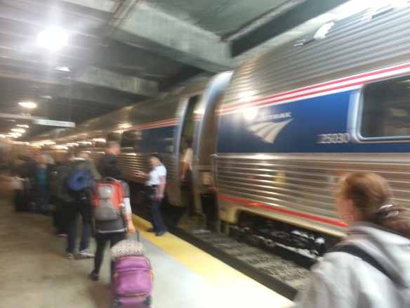
Right off the Garden concourse is the mainline North Station, commuter rail hub for points north (and thanks to the listing nature of the Fitchburg Line, some which are actually WSW such as Belmont and Waltham) and terminal for Amtrak’s Downeaster to Maine. The relatively recent remodel has made the station look pretty modern while actually giving enough space for commuters and event goers to peacefully exist on certain nights. This is quite the improvement over the cramped concourse from the mid-1980s rebuild of North Station, one built without ever thinking it would be attached to an arena with 3500 more seats than its predecessor.

Under North Station and right down the street is the subway station of the same name. The current incarnation of North Station [Under] is one of the crown jewels of the MBTA system with its modern decor and its ingenious cross platform transfer setup between the inbound Green (C and E branches) and Orange Lines and not much effort to get between the two lines going outbound. Given the double duty that it has to do its namesake rail terminal right above and the Garden right behind that – often with both colliding – it does its job well and is probably the most well thought out transfer station on The T, granted it has decades over its competition. In terms of transit/arena access, it isn’t to the level of Madison Square Garden/Penn Station or Forum Centre Bell/Lucien L’Allier ingeniousness, but compared to others it might be seen as enviable. However, it always hasn’t been the case.

Growing up in eastern New York, I was blessed enough to see and use both “original” North Stations, the Causeway Street El station and the old surface station (I also was lucky enough to tour the Original Garden). Seeing the skyline and both Gardens – and for a couple years, seeing both was possible – was a sight that sadly future generations won’t be able to see from that vantage point. However, the cost of the charm and the views and that area being defined by the El had its prices: there was a single staircase for entry and exit, a single token machine, and if you wanted to transfer between lines you had a frustrating barricaded maze which made Haymarket look good. As much as it was functionally obsolete and had to be replaced due to neglect, the last time I rode through on the El several months before it was closed I felt that with it’s demise a bit of Boston would die with it. This isn’t all from the past. The surface station, after a while became a frustrating relic when you just knew that having four terminals was a bit too redundant and my one experience with it was visiting the aforementioned Garden hearing my Mom and Aunt act confused about why there’d be two distinctly different North Stations.

Flash forward to the present. I’ve used the current North Station several times but am impressed about how there was a lot of foresight in expanding it to the size that it is. In contrast to the “Kenmore Krush” after Red Sox games, using North Station after a Bruins or Celtics game is a pleasure as there’s more than enough room to for people to wait for their trains comfortably and safely. The joint platform has semi-intended benefits for the Green Line as it can have two 2-car trains on the platform with plenty of room to spare. Even those headed outbound have a good amount of platform space to sprawl out on. Having dealt with the transfer choke point in DC with the Gallery Place/Verizon Center combo and having done the walk of shame from Core States First Union Wachovia Wells Fargo Center to Pattison AT&T in Philly in a monsoon, North Station looks pretty great in contrast and deserves all the appreciation it can get. Let’s go Bruins!

Station: North Station
Rating (1-10): 8 – a solid 8 for both commuter rail and under.

Pros: The building of the Superstation and the enlarging/semi-segregation of the commuter rail terminal has made what once was a debacle a manageable experience. The Blackhawks won the Cup, but their transit situations (long walks to stations and special buses) are primitive in contrast to Boston and fans I know are envy in what Bostonians have. Also, during the week the station is the terminus of the 4 to downtown and the Waterfront and the Charles River TMA bus to CambridgeSide and Kendall Square.

Cons: Outside of some minor wear and tear (chipped tiles), putting 145′ of Green Line train on a 400′ platform during middays and nights makes sometimes getting on or off a challenge. On the outbound platform, the first car stop is far from the staircases/escalators while inbound there sometimes is a mad dash for a car. And yet it isn’t as bad as the Shady Grove-bound platform at Gallery Place in DC…

Nearby and Noteworthy: There are many, many places to either watch a game if you can’t get tickets or to go before/after a game if you do have tickets. My recommendation is The Fours, sponsor of trivia on Bruins games on NESN among others.

459 (Salem Depot-Downtown Crossing EXPRESS)

As I mentioned in my rant about MBTA line bias, my entire summer has been an overworked, underemployed blur in which I entered a heavy rut which distilled my riding to about six different routes/modes. I needed a ride to get me out of the rut of academic writing about stuff like economic embargoes (and stuff that matters like counseling to help families of children with disabilities and illnesses adapt to their new lives). Our proverbial slumpbuster in this case, a route I might not think about otherwise, is the 459, a route semi-unique among the North Shore routes which should be a model of sorts.

The 459 is one of two express routes stretching from Salem Depot into Boston, this one of the most part paralleling the 455 from its origin to Bell Circle in Revere going around Salem’s east side via Lafayette Street and Loring Avenue past the Salem State University campus into Swampscott. After reaching Vinnin Square, the heart of Swampscott’s business district, it transitions onto Essex Street which becomes Union Street in Lynn. Meeting the nuculus of North Shore routes at Central Square, it goes around Lynn Common and eventually passes by West Lynn garage. It is shortly after this I join in.

My ride began at the sole stop the 459 (and 450[W]/455) have in Saugus, the stop located at the corner of Western Turnpike/MA 107 and Ballard Street. Heading towards Lynn, it’s a typical stop but heading towards Revere/Boston riders get an old makeshift cinderblock shelter which a reader referred to as a “rape hut”. I know the nature of that area is very industrial and at that point MA 107 is a divided four-lane road but no shelter would’ve been better than that monstrosity because even on a bright sunny day it looks foreboding. Luckily a bus came right as I arrived, about 2/3 full which is par for the course for midday express runs from the North Shore.

Leaving that bleak shelter, the 459 eventually follows MA 107 to its end at Brown Circle, then MA 60 to its end at Bell Circle where it uses the center bypass lane to get on MA 1A and the route becomes dominated by a big box complex, Suffolk Downs, and a lot of services geared towards persons headed to/from Logan Airport largely that of the offsite parking nature. This sets the tone for one of two main discharge points for the 459, Logan’s Terminal C where about half the bus got off. After going through the Ted Williams Tunnel and a few stops on the Waterfront, the 459 ends with a stop near South Station and a couple of street stops before its end at Federal and Franklin streets alongside most of the 500-series express buses bound for points west and the limited rush hour service of the 448/449 from Marblehead which parallel the 459 from Bell Circle on south. The rest of the bus used either the South Station stop or the Downtown Crossing terminus.

With headways on average of every 70 minutes or so from AM rush to PM rush (a measure so that resources are limited) and a run time of around that length, on paper the 459 would seem to be like a throwaway to toss a bone for the North Shore crowd to get to Logan and to have an alternative to Haymarket. In fact, the route has a lot of potential, if not for itself for the whole 400-series as a whole.

  • Even with the North Shore express network pared down, there is a “Haymarket or Bust” mindset which puts one transfer point among others. The 459 shows a market for a North Shore to South Station connection, what harm would running the 426/450 down Atlantic Ave to terminate at the Dorchester Ave/Summer Street stand the 459 uses? With the Waterfront booming, this cuts a four-seat ride to two seats.
  • Running some 426/450 peak runs via the Ted Williams Tunnel could work as a relief valve for their regular crossings.
  • Soon enough the whole North Shore network is going to get semi-isolated on the weekends when Government Center closes to be rebuilt making the Blue Line an eunuch connecting to only one other line. Weekend 459 service would be a good alternate especially given how it hits all the key spots in the heart of Boston (then again, so would running the 426W to Malden or Wellington instead of Wonderland).

The 459 is a nice little route and some lessons could be learned from it, problem is does anyone want to learn those lessons especially as the North Shore enters a state of transit flux.

Route: 459 (Salem Depot-Downtown Crossing EXPRESS)
Rating (1-10): 7

Ridership: As in the local portion headways are coordinated with the 459, there probably is a healthy amount of ridership between Salem/Lynn and points in-between. By the time I got on, there was a crowd which was 95% bound for Logan or Downtown with Brown Circle the other destination. As with any North Shore route, a good socioeconomic mix too and the Logan crowd was an even split between travelers and workers.

Pros: It’s a North Shore route that doesn’t go to Haymarket! It’s one of the few non-Silver Line routes that serves Logan. What else is there?

Cons: Outside of the 426 and 450, the North Shore express routes are a bit of an afterthought and though this isn’t as bad as thrice-daily 428 or the once-daily 434, this could use a little more service. How it could be divided especially since other routes could use service to its terminus would be a big problem.

 Nearby and Noteworthy: Heading inbound, there’s one of the few standard format “Entering Boston” signs and leading into Logan you can actually see the top of Airport station (which at 9 already needs some new top windows). Not much else in terms of stuff and I need some reason to give the 455 a ride someday.

Cleveland Circle & Reservoir

The other day, I was speaking to someone whom lives out in Metrowest who was bemoaning the lack of Applebees in that area. Somehow, the closest one to her is the one located near the Boston College campus, within sight of Cleveland Circle. I had a partial review written for a while and with grad work eating into my time, I’d might as well give everyone a two-fer and toss Reservoir down the street as a bonus.

Cleveland Circle and Reservoir are separated by only a tenth of a mile (shorter than Ruggles and Northeastern) and in many regards are treated as a common station. The two share a Wikipedia article and in a more official capacity share a bus loop where the 51 and 86 buses terminate and the signs for buses bound for there give equal billing to both stations. While the two are seen as equals, the two stations have contrasting personalities which make themselves unique.

The terminus of the C branch, Cleveland Circle sits at the end of Beacon Street after it re-enters Boston after its jaunt through Brookline. Framed by the Chestnut Hill Reservoir to its immediate west and a nice row of businesses, it sets the tone of how a classic median-running trolley line should be and serves as an eventual teaser for its trip through Brookline before heading underground. I’ve always seen the C as the “happy medium” of the above-ground portion of the Green Line and being a terminal seats for the ride into town are always plentiful.

In contrast, Reservoir reflects the D’s heritage of the old Highland Branch, grade separation and all. In fact, to get to Reservoir one usually must pass Cleveland Circle which in theory would hurt ridership except that the D has the advantages of more than half the stops (5 to Kenmore in contrast to the C’s 12) and no grade crossings. This on average shortens trip times by several minutes but at times can come at the price of many seats already being taken by commuters from Newton and points further west. However, the overall greenery surrounding the D is just as good of a substitute for the charm of Beacon Street so making a decision can be hard at times.

Like any pair of siblings, the two stations look out for each other with the non-revenue track linking the two to Reservoir Yard (and onward via Chestnut Hill Avenue to the B) having allowed in the past such arrangements as running the D via Beacon Street when track work was necessary east of Reservoir. For those with a pass or who are railfanning, the quick walk makes it a good transition point between lines and even to get to the B is only a 7 minute or so walk. As with any siblings (especially twins), my best advice is to not choose favorites since both have their own roles and purposes.

Stations: Cleveland Circle & Reservoir
Rating (1-10): 7

Ridership: Local with a lean towards BC students and family during the school year who don’t want to deal with the often arduous trip on the B (which the walk from Cleveland Circle around the reservoir cancels out). There are some local generators though.

Pros: The ability to choose between two stations. For Cleveland Circle, its setting and always being able to get a seat. For Reservoir, trip time and access to buses plus being able to see Reservoir Yard.

Cons: Having to choose if you’re in a spot to choose. For Cleveland Circle, a slightly longer trip time. For Reservoir, front door boarding does not and never will work on the D as the D wasn’t made for such stuff.

Nearby and Noteworthy: Eagle’s Deli. If you need to have something to bring you here, this is it given the all-around amazing menu. When media ranging from Fox’s coverage of the World Series to Man v. Food have profiled a place, you know it’s good. If you’re daring and have money to burn, try the lesser Challenge burgers and if you’re really daring and can eat (as of this writing) 5 pounds of burgers with 20 slices each of cheese and bacon and 5 pounds of (very good) fries, $59.95 will buy you immortality.

The aforementioned Reservoir Yard is worth a look-see from the outside fence given it’s home to much of the Green Line’s work equipment including the remaining work fleet Boeing LRV’s. Just stay away from the rotting, to be demolished, brutalist carcass of the former Circle Cinema as it will case nightmares.

Back Bay

Growing up and visiting Boston once or twice a year, I’d almost always drive into town via the MassPike and we’d pass by the assorted sites of Boston. Under and around BU, right by Fenway, under the Pru, then right past Back Bay[/South End] with its mixture of commuter rail tracks with the Orange Line wedged between. Passing Back Bay meant that I had made it to Boston and at this point the last challenge myself and whomever I was traveling with had was finding parking or a place to get off our tour bus. Heading home, it was one last taste of seeing MBTA action, B at BU West or a Framingham/Worcester Line train after a successful trip.

That said, lately I’ve ended up at Back Bay quite a bit for engagements in the area, being a quick commuter rail ride from South Station is part of why, so now is the time to review one of the more key T stations out there. The current incarnation of Back Bay is the northernmost/easternmost station on the Southwest Corridor alignment carrying the Orange Line alongside Amtrak’s Northeast Corridor and serves as a major transfer point of sorts connecting the Orange Line to the Framingham/Worcester, Providence/Stoughton, Franklin/Forge Park, and Needham commuter rail lines, Amtrak’s Northeast Regional, Acela Express, and Lake Shore Limited lines, plus the 10 and 39 buses as well as connections between each other. Also, the Orange Line makes this the simplest connection between the Northeast Corridor lines and the Downeaster at North Station. In theory, Back Bay should be an important station but in actuality it’s quite a bit worse for the wear.

Walk into Back Bay and save for LED signs and vending machines you’ll feel like you were transported back into the 80s given the decor. Though there has been some upkeep, there are parts that look like they’ve barely seen changes in the 26 years since the current incarnation’s opening. Entering the station, it forks into three different forks, which going from south to north are as follows.

1: Tracks 1-3 have two high level platforms and serve Amtrak’s Northeast Corridor trains and southbound commuter rail service. These platforms are visible from the MassPike and are partially exposed to the outdoors with the ends closest to the station enclosed. Your biggest risk here is running into hoards of commuters especially as the exits are at the far south/west end of the platform.

2: The two tracks of the Orange Line which are located one story underneath the main concourse in a shallow tunnel. Typical Southwest Corridor setup, not much to see here, exit at the north/east end of the platform.

3: Tracks 5 and 7 which carry the Framingham/Worcester Line and the Lake Shore Limited. Unlike the two others, these tracks have mostly low-level platforms with a mini-high at the way end at which point the platform extends into a tunnel and has a very odd feeling. In fact, it may be the most unusual if not creepy part of the MBTA/MBCR system and I’ll let regular reader and fan @BostonUrbEx explain.

“[The westbound platform is]  the strangest place on the T that I’ve ever been, I think. Not only that but some homeless man chased me away when I was looking westward into the dark tunnel, and I had a little flashlight on me in my bag so I was using that, then he came out from behind some concrete walls and just stood there grumbling, I was freaked out and tried to casually make my way off and then he followed me, stopping every time I looked back.” 

All Aboard for Framingham, Worcester, Springfield...Albany-Rensselaer...Chicago!

All Aboard for Framingham, Worcester, Springfield…Albany-Rensselaer…Chicago!

Toss all of this in with a ton of diesel smoke, enough for some to call Back Bay a “lung cancer chamber” and for public health officials to ask those with lung conditions to avoid it, and you have Boston’s third major rail station. The smoke is at its worst on the westbound platform as it’s mainly enclosed and the mini-high is at the way end. I’d hate to see someone needing to use it with lung or pulmonary problems to have to go through torture just to ride a train.

The concourse itself can use some improvement as it has a couple small stores and and two Dunkin’ Donuts and not much else outside its ticket windows. Its two exits show a good contrast of how life is on the other side of the tracks/Pike, exit onto Dartmouth Street and you have the heart of the Back Bay plus the 10 to City Point in South Boston.  Exit onto Columbus Ave and you have the up and coming South End, the terminus of the 39, and the two rush hour round trips on the 170 to Dudley and Waltham. There’s more to do on the Dartmouth Street side but the Columbus Ave side has phantom exits, track views, and a sign salvaged from the prior Back Bay. There also is a convoluted tunnel which connects Back Bay to the Prudential Center (and Prudential station) which comes in handy when rain or navigating pedestrian-hostile intersections are in the way. Choose your adventure.

Station: Back Bay[/South End]
Rating (1-10): 4 (5 for the outside architecture and Orange Line, 4 for the NEC platforms, 0 for the westbound platform)

Ridership: A good mix of commuters and residents with the former heading more onto Dartmouth Street and the latter more onto Columbus Ave. The collection of nearby offices makes this a key stop on the Commuter Rail and often at rush hour the platforms are packed. Amtrak gets a decent amount of ridership and being in the neighborhood one day when the Lake Shore Limited comes in I saw 30 people board for points west.

Pros: It’s the main rail connection to the South End and is a very good bypass for when the mainline of the Green Line is snarled. The outdoor architecture is a bit akin to a urban version of Alewife. It also is a good connection to suburban and inter-city transport.

Cons: This station should come with a Surgeon’s General warning and westbound passengers should be given respirators if not oxygen masks. Besides that, improve some of the lighting on the Orange Line/southbound platforms and a LOT of lighting on the westbound platform and put in a better ventilation system and that rating would go fast. As with the rest of the Southwest Corridor, Back Bay answers a question that wasn’t asked a clearly as the answer warranted.

57 (Kenmore-Watertown Yard)

I had originally begun writing a draft about a review for the 57 a couple of months ago and that review would’ve been centered on a trip I took 3.5 years ago. Now that Watertown, for reasons better or worse, has had its day in the global sun, I mulled re-posting that review but instead decided to re-ride the route and rewrite this review.

On my original trip, I got on at Watertown Yard after a ride on the 71, walking across the by-then-narrow Charles from Watertown Square. After the commercial strip from Watertown to Newton Corner, the 57’s route goes through some pretty residential areas until it hits Oak Square in Brighton where it becomes more commerical before reaching Brighton Avenue in Allston and eventually meeting Comm Ave at Packard’s Corner. I ended up bailing at Pleasant Street at the sight of the then-brand-new Raising Cane’s being miffed that they’d be open so north and having never been.

Fast forward to the present and for a launching point I decided to start where I ended years ago and do the trip in reverse. After a few minutes of waiting, the 57 showed up with a half-full load which made its way down Comm Ave from Kenmore, often racing the B in the process. The overlap of the two modes goes for another half-mile before splitting and following its trolley predecessor. Along the Brighton Ave stretch of the 57, you can notice the former center median where the A run and you can wonder “is this really progress replacing trains with a bunch of granite, grass, and the occasional flower?” If you examine the A up until Union Square, I assure you you’ll shake your head at how short-sighted the MBTA was to walk away from a route which still thrived sans rail and that it’d give additional capacity for the BU portion of the route.

As Allston blends into Brighton, the pace slows and you see the quaint streetcar suburb which formed around the now 57 with a quaint main street dotted with restaurants, small shops, and an assortment of dwellings. With the length of the route, you may also wonder how generations before who had the the then-A kept their sanity commuting to and from Boston given the frequent stops. After Oak Square in the heart of Brighton (terminus of the rush-hour 57A short-turn and express bus service), the 57 eventually blends into northern Newton and has more of the same charm with the added liability that they’re the main reason why the A was left to die.

At Newton Corner, the 57 avoids the time-consuming loop the express buses make and continues straight into nearby Watertown. Getting off at Watertown Yard, you see the abandoned track leads still embedded in the pavement and you may mull if the right thing was done with the predecessor of the bus you just rode. Odds are, unless you’re headed to Newtown Centre, Needham, or Dedham, you’re walking across the river to see how great preservation can be.

Route: 57 (Kenmore-Watertown Yard via Brighton Ave)
Rating (1-10): 7

Ridership: The pre-2007 service pattern of limited stop service on Comm Ave (pickup-only outbound, discharge-only inbound) still seems to linger as very few people get on inbound/get off outbound in the shared portion. Those getting on before are bound for western Allston, Brighton, or Watertown and those heading inbound will just stay on until Kenmore. There’s some local ridership too, heavily centered on those in the residential areas or Allston.

Pros: Save for portions of Brighton Avenue where the 64 and 66 also operate, the 57 is the sole bus service for a good swath of Boston and it is a key connector for an area with heavy transit use (Allston) to the rest of the system. The scenery in Brighton and Newton is also quaint New England suburban in all the right ways.

Cons: This used to be a trolley and spent a quarter-century dying on the vine for what? There are so many what-ifs on the history of this route – what if someone made trolleys for the 20+ years between the PCC’s end and the Boeing LRV’s start, what if Dukakis had political will to restore the A – that it could be a post of its own.

Nearby and Noteworthy: On Brighton Avenue, there is the wonderful Sunset Grill and Tap, along with its next door neighbor Patron’s and back on Comm Ave their sister Sunset Cantina. All three have some very off the wall menu items and have alcohol selections. I recommend reading your menu and bringing your wallet and an empty stomach because you will love any of the three.
For the sake of history, the Oak Square Dunkin’ Donuts has many pictures of the former A branch adorning its wall which sets it apart from the several other Dunks on its route.

Some Quick Easy Fixes

Well, it looks like the doomsday threats are coming back, and this time on top of the threats of killing weekend commuter rail are the threats of ending all bus service after 11:00 PM and cutting 30 bus routes. Here are some simple fixes that the MBTA should consider.

1: MassDOT merged everyone together into a bickering blended family. They should own up to their Big Dig debt.
As much as the crowd outside of 495 will claim that they should not pay for the debt of the Big Dig because it’s solely inside Boston, truth is that it is a utility for the entire Commonwealth and beyond. The Big Dig benefits just as much benefits those from Salisbury to Sheffield to Sandwich as it does for those in Southie and Somerville with improved vehicular capacity through town, improved access to Logan, and more.  When the Commonwealth merged everyone under the MassDOT umbrella, they should have demerged the Big Dig debt which the Cellucci Administration forced upon the MBTA for something they really did not contribute to. One umbrella, one debt.

2: Merge some lesser bus routes into singular routes.
Several years back when the Port Authority in Pittsburgh had their own Doomsday cuts, they ended up merging several routes which shared a common terminal into singular routes to help boost efficiency and maintain as much service as possible. I was going to suggest these in a proposal post but here are a few which could be done.

  • Merging the 62 and 76 full-time as the current 62/76 operates on Saturdays.
  • Combining either the 70 or 70A with the 91, running straight through Central between Waltham and Sullivan.
  • At least on middays and weekends, merging the 108 with the local portion of the 426 (which would help West Lynn, East Saugus, and northeastern Revere as the Blue Line will  soon be an eunuch).
  • The 354 is extended over the local portion of the 352 after rush hours. As much as it’d be bad for Burlington commuters outside of 95/128, making this the core route would not be  bad thing.
  • Merge the 131 and the northern/eastern portion of the 430 while terminating the 430 at Square One Mall. This would not only add an elusive bus connection between Saugus and Melrose, but would also redirect the 430’s resources where it’s needed.

(Everyone, join in and leave your suggestions in the comments!)

3: Make pass prices resemble something resembling reality.
Right now a weekly pass ($18) is only 1.6 times the cost of a one-day pass ($11) and is equal to nine rail rides paid via CharlieCard. I understand the one-day pass is a bit of a tourist tax but seriously the weekly pass could be raised to around $24 and still be seen as a bargain. Similarly, $70 for a monthly pass is still quite low compared to the MBTA’s peer agencies and could be hiked beyond $80 and still be seen as a bargain.

4: Charge for CharlieCards (and maybe CharlieTickets too)
When I was living in and around DC,the initial cost for a SmarTrip was (as is now) $5. In contrast, the CharlieCard is free. I’m not saying to emulate WMATA – nobody ever should – but even if the MBTA charged as little as $2 for a CharlieCard it’d make some money. Imagine how much they could’ve made over the last eight years off of CharlieCards for a nominal fee.
Similarly, the MTA in New York is now charging $1 for a new MetroCard. I think even a 50 cent surcharge on getting a new CharlieTicket would raise some extra funds and would show those that use them that getting a CharlieCard would be a good move to make.

5: One More Quarter
Compared to peer agencies, even with last year’s fare increases CharlieCard fares are still cheap at $1.50 for bus and $2.00 for rail. Hiking these by a quarter while leaving the $2.00/$2.50 cash fare as-is would still have the MBTA on the low end of their peer agencies. Ideally, going to one united fare would be good but the insistence of having bus be cheaper than rail would need to be put on the back burner.

6: Peak hour MBCR surcharges
Being from the New York area, I’m used to the concept of a peak-hour surcharge on both Metro North and the LIRR, charging a higher fare going into Penn/Grand Central in the morning and out in the evening. I know the MBCR lines don’t have the intensive levels of service that their New York counterparts have, but a surcharge of a couple of dollars for trains during rush hour would help raise some extra money from suburbanites. There are some problems with this, namely if the Zone 1A and Fairmount Line stations should be made exempt or not, but it’s worth the thought.

7: Take one for the team, Local 589
With service cuts come the inevitable complaints about unionized labor and all the negative stereotypes of unions and the “typical” unionized employee. While Local 589 doesn’t have the overtime abuse problems of TWU 100 and the other MTA unions or the mass corruption at ATU 689 at WMATA, I think that it might be a good PR move for Local 589 to make some concessions to help protect their jobs. Given the choice between voluntarily taking a pay rollback of a couple of percent and having jobs flat-out eliminated, I’d be willing to take that most Local 589 members would seriously consider the former. Such a move would be a sign of solidarity and would send a good message to a union-cynical public in a time when unions need the good PR.

I have one other bigger idea I’ll share in another post, but these would be better than getting rid of all weekend Commuter Rail service or ending bus service a good two hours before subway service. Then again, doomsday is doomsday and often doomsday never comes.


66 (Harvard-Dudley via Allston & Brookline)

Early in this Adventure, I reviewed the 1 and harped about its crosstown time-saving abilities even in the face of its being prone to chaos and bunching (and if you’re new here, I recommend going back and reading it). Now imagine if the 1 moved a couple miles east for most of its route and gained more chaos. Then you would have the 66, the 1’s wilder and we assume younger sister.

The first time I rode the 66 was on the advice of a friend who then was at grad school at BU after getting lunch in Brighton one day several years ago. Having been an out-of-towner who stuck to the familiar and who was ready to take the B back to Park to get the Red to Harvard, at the time I wouldn’t have known of it otherwise until she suggested it to me. I walk to the corner of Brighton & Harvard Avenues and wait for the 66 to come. Coming from Dudley, it had worked its way past an Orange Line connection at Roxbury Crossing and had a whole bevy of meetings with the Green Line: the 66 parallels the E from Museum of Fine Arts to Riverway and meets the D at Brookline Village, the C at Coolidge Corner, and the B just down the street at Brighton Ave.

When it arrives, it’s packed with a heavily college student crowd with a veritable melting pot filling the balance as the diverse population of Allston can attest to. By some miracle, I got the last seat and was able to take some notice of the rest of the route including Harvard’s athletic facilities and the BU Bridge even through the throng of people made noticing hard as with any route with college-heavy ridership. As with the 1, it stops right outside Harvard station for ease of routing purposes. Since then, there has been a common debate about if the 1 or the 66 is the more chaotic route. I decided to take little study to see if the 66 was actually the more chaotic one.

In about two hours camped at the Starbucks at Coolidge Corner on a weekday with school not in session, I noticed that the average 66 ranged from ¾ full minimum to being packed to the gills maximum without any missed runs or bunching. But watching buses while trying to pursue a better life isn’t the point of this blog. Therefore, I got on a mostly full 66, took a seat, and rode for a bit. A bit less young than years earlier but still busy. Harvard Street in Brookline is a slice of charming suburbia and is worth the trip on this portion of the 66. Eventually I get off at Brookline Village while the 66 eventually works its way back into Boston and onto Huntington Ave.

Route: 66 (Harvard-Dudley via Allston & Brookline)
Rating (1-10): 7


Ridership: Heavily on the young side when school is in session though not prone to being a party full of the male “bro crowd” (thanks @nikkif610) and/or the female “Uggs and yogas crowd” a la the B and E. You see a decent amount of people using this as an outer transfer between branches and lines too.

Pros: Similar as the 1. Invaluable route that connects many transfer points and can link together many outer points with a one-seat ride. As one of a few north-south routes to operate in Brookline, it is also invaluable for crosstown travel in that direction versus the more covered east-west corridors.

Cons: Ridership is heavy and when schools are in session packed buses often are the norm. If someone has the idea to get more CNG artics, this route with the 1 would both be prime candidates for them.

Nearby and Noteworthy: Hidden among Harvard’s athletic complex on the south bank of the Charles is Bright Hockey Center, home to Harvard’s pair of hockey teams. While it lacks the flashiness of BC’s Conte Forum or BU’s Agannis Arena or the 100+ years of history of Northeastern’s Matthews Arena, it has its own charms including very 70’s light fixtures and curved bench-style seats. If you sit up close, you can actually hear the puck go around the dasher boards.

Ruggles & Northeastern (a twofer!)

Picture it: Several months ago. Your webmaster is in a tug of war with Northeastern because, well, they lost his transcripts needed for enrollment in a grad program and my last option was to hand-deliver the transcripts. At this time, I was seriously in a commuting rut which I actually wrote about so I had decided to kill two birds with one stone by knocking off two stations in one trip. Two blocks separates Ruggles from Northeastern and the former can be seen in the distance from the latter. However, the two seem like totally different beasts.

A creation of the Southwest Corridor, Ruggles is a station that ties the Orange Line, Commuter Rail (Providence/Stoughton, Franklin and Needham lines), and many local buses together bringing passengers from points south and west. This was apparent during rush hour as I saw a mass of people get off of a Forest Hills-bound train, most bound for buses or the commuter rail even with a redundant transfer two stops north at Back Bay. The three parts of the station, are tied into a long concourse which runs as a pedestrian continuation of Forsyth Street towards Tremont Street that also includes a Dunkin’ Donuts and a good-sized mini-mart plus has hot dog and Jamaican beef patty carts during lunch hours. In terms of overall footprint, Ruggles is probably the largest station in the MBTA system which doesn’t have some sort of parking element and it may dwarf some stations with some parking (Oak Grove comes to mind as one).

In contrast, Northeastern is the final surface station before the E line enters the Huntington Ave Subway and is for the most part a run-of-the-mill surface station in a street median. Ten minutes after I got off at Ruggles, the platform was nearly vacant though it started to fill up no doubt due to delays on the E that day. By the time a train came, the train was packed and mercifully platform fare collection was in effect that day since adding us to that train was barely done with six doors of 2 cars open let alone just two. Since this original trip, I’ve gone back a couple of times for other matters, namely one that would’ve made me simultaneously a Northeastern employee as well as being a student. I can say that when class isn’t in session it’s a lot less frenetic and is at times a bit pleasant especially considering the massive size of Ruggles.

Which one is best? It’s up to you and I’ll let you decide. Leave your take in the comments!

Stations: Ruggles (Orange Line) & Northeastern (Green Line – E)
Rating (1-10): 7, this as a combined unit.  

Ridership
Ruggles: Lots of passengers transferring for buses and commuter rail, the latter more often than not Northeastern stakeholders. Given how the E line often can be, Ruggles often can get overrun with Northeastern students wanting a saner ride into town but this primarily is a bus-to-rail transfer point for the South End, Roxbury, and to some degree Jamaica Plain.
Northeastern: Students. Lots of students. Though not as bad as the BU trio on the B Line, when school in session the platform often can be packed, sometimes it can get a bit crazy even Ruggles, Symphony, and Mass Ave all alternatives.

Pros
Ruggles: It gives an alternative to an often-beleaguered trolley line and gives both Northeastern and the South End the transit hub it deserves. Bus traffic here is bound for all corners of Boston.
Northeastern: The University and Huntington Ave were all there first and for an out-of-towner looking solely at a map they’ll gravitate here first and on occasion the stub track just south of Forsyth Street is home to work equipment which can be a treat.

Cons
Ruggles: There is some dinginess around the station but this is often to be expected with newer stations which haven’t seen rehabilitation. There also is the fact that if this was New York or Washington, this would have had a tag for Northeastern years ago.

Northeastern: Where trains stop heading inbound is far from the actual entry point. Often there is a mad dash for a train if one is approaching, often without the best results. Also, being on the E, being on the first train after some delay or disruption is not a pleasant experience for sure.

Nearby and Noteworthy: Ruggles sits on the site of what was the South End Grounds, a trio of ballparks which were the homes of the old Boston Braves. The Northeastern-owned property right on the west side of Huntington Ave, in contrast, was the site of the Huntington Ave Grounds, original home of the Red Sox. Both have markers of their status around the area. 

Haymarket

One of the hardest things to write about is something that is a little too familiar to write about. Since moving here I’ve been in and around Haymarket probably over a 100 times given the number of times I’ve ridden the 426 into town. I know all of the special ins and outs (5th car heading towards Forest Hills for an easy exit!), where to wait on the platform, and more but otherwise Haymarket is a bit unremarkable of a station especially for one that is a transfer point and sees quite a bit of traffic.

The southern transfer point between the Green and Orange Lines, Haymarket in its current form is a product of the early 1970s when the previous three stations using some variation of that name were combined into one by extending and relocating platforms. This move was long overdue and finally created a unified station for the North End and in spite of the then-elevated Central Artery eased access there and building a garage on top of its north entrance has helped spur some traffic. However, the station has not aged well with tons of exposed brick for both parts of the station. Look at this picture of the Green Line at Haymarket in 1980 and not much has changed at least on the Green Line level since. The Orange has seen a little change in terms of columns but not much else.

Oddly enough, the non-station parts of the station have seen renovation within the last decade. The southern entrance on Congress Street was totally redone to accommodate ventilation towers for the I-93 tunnel plus the connecting passageway between Orange Line tracks all got new tiling and lighting. In the case of the passageway, this was somewhat for naught as there is a spot in its ceiling that produces an eternal leak which could have been a minor generator for much of Haymarket’s transfer traffic migrating to North Station after the Superstation opened. However, Haymarket has a lot more going on near it than North Station often does on a regular basis, so…

In addition to serving people bound for the North End, Haymarket is also a hub for connecting bus traffic especially during the week. Though pared down by recent cuts, the north entrance is a terminal for express buses coming from the North Shore while during rush hours and the south entrance entertains the 325/326 to Medford; express buses to Burlington and Woburn are nearby though a bit difficult to find. There is also local bus service as the 92 and 93 stop by the south entrance while the circus known as the 111 boards from the north entrance bound for Chelsea across the Tobin Bridge. The heavy ridership of the latter and the cut in express service led to the recent swap of busways at Haymarket.

I may be numb and desensitized from all the sprints up and down staircases I’ve made and the walk from the north and south entrances to transfer from buses and time spent inside the Dunkin’ Donuts at the north entrance but Haymarket is a nice, if not slightly outdated and awkward, station.

Station: Haymarket
Rating (1-10): 6 (with 1 of that just for familiarity)

Ridership: Heavily influenced by the nearby North End with a good side of people coming in from Chelsea (the 111 often leaves packed and during rush hour is often in “load and go” mode). Expect to see a lot of Dunkin’ cups and Mike’s Pastry boxes at times depending on tourist demand, suburbanites in town or both.  During the week, swarms of commuters from the North Shore also descend here though after the recent purge of express routes it’s less than in the past.

Pros: As dated and unspectacular as the architecture is – the busway area has 80’s architecture reminiscent of Alewife and JFK/UMass – it’s a multi-modal terminal and a connection to one of Boston’s most historic and desirable neighborhoods. Also, it provides a wheelchair-accessible alternative to the currently-inaccessible Government Center and Bowdoin.

Cons: The eternally leaking corridor between Orange Line tracks and the dated décor take a ton away from the good of this station. Though the recent cuts and realignment may have helped, the busways during rush hour often become a massive mess too.

Nearby and Noteworthy: Too much to list: The eponymous produce market is right around the corner on Fridays and Saturdays, the northern end of the Rose Kennedy Greenway is at the station, and the North End has dozens of restaurants and is a hotbed of Italian culture. In 2014, the Boston Public Market will open a year-round building in an area surrounding the southern entrance. There’s also Saus, an establishment that sells Belgian-style frites and the best poutine I’ve had outside Montreal.